I just pushed the window blind down along our dinette to no avail. It’s still black out. This is when I write – before dawn goes down to day and the color of my thoughts is – usually – still gold. But this is not about when; it’s about where. The last thing I wrote was in this exact place, where Holly and I are doing the same work we did here last year: sharing a little pueblo with travelers. My last piece, Lake of Gold, spells this out well and I stand by it, so much so that it feels that this morning’s thoughts haven’t skipped a beat since then. I like this feeling. I feel lucky to have just a glimpse of the ancestral sense of time embraced by those who passed over this land, a sense that is cyclical and tied to real events of the spinning cosmos as well as to the spirit’s place in the world with its responsibilities and gifts. Time becomes a meadow of blowing grass.
In this spirit, Holly and I announce some news. We, too, will occupy a small chunk of Arizona desert, though not in a traditional way. If I showed up on a piece of land, built a little pueblo of native stone and mud, let my community grow with birth and migration, and planted a little three-sisters garden – I’d be run off, or worse. So we had to buy a rectangle. Here’s the legal description:
PARCEL I:
That portion of Parcel 9, RIO RANCHO ESTATES II, as recorded in Book 11 of Surveys, page 35, records of
Cochise County, Arizona; and corrected in Book 13 of Surveys, page 71, records of Cochise County, Arizona, lying
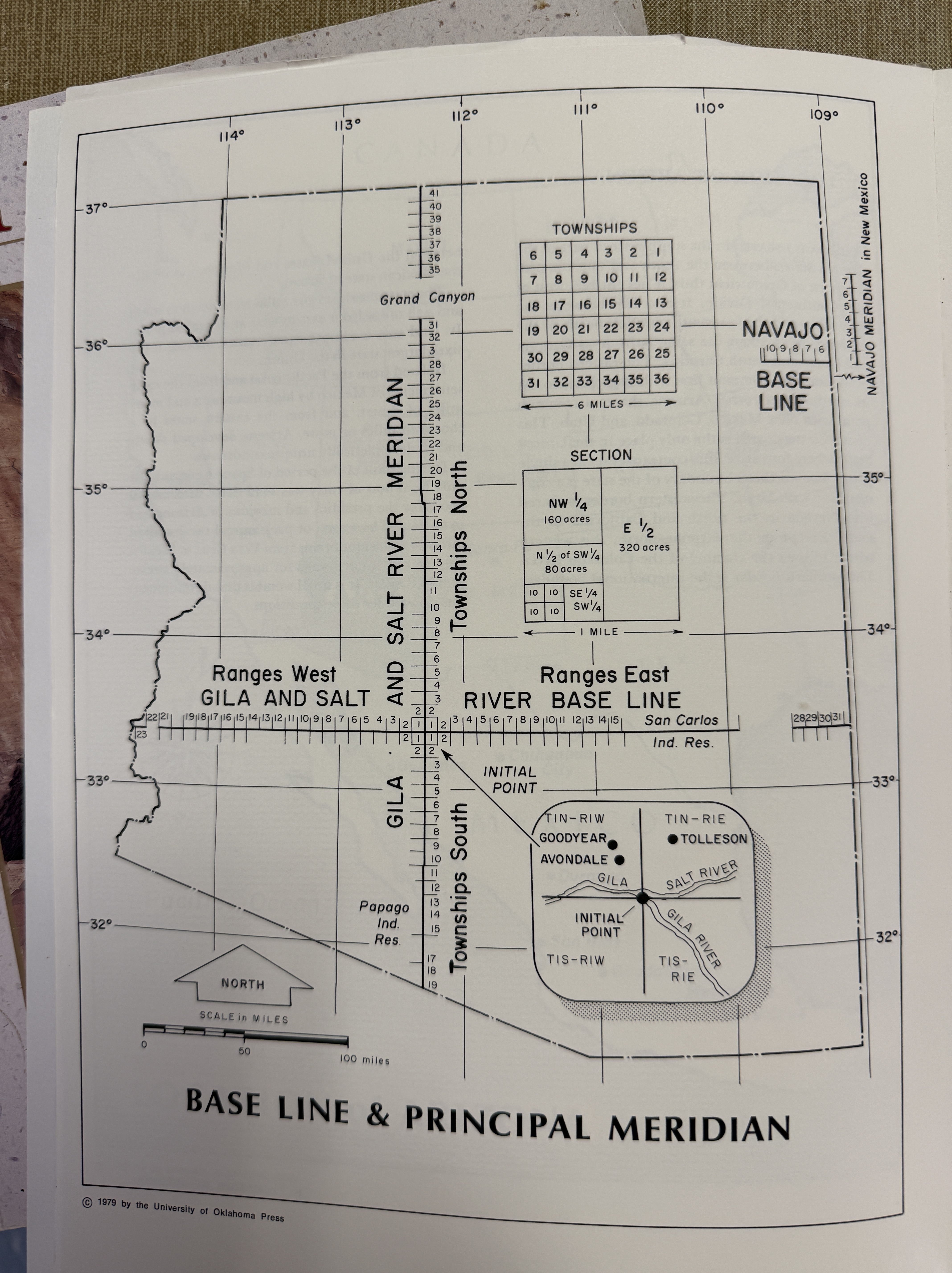
within the Southwest quarter of Section 30, Township 23 South, Range 22 East of the Gila and Salt River Base and
Meridian, Cochise County, Arizona, more particularly described as follows:
COMMENCING at the Northwest corner of said Parcel 9, identical with the West quarter corner of Section 30;
thence South 00°12’58” West coincident with the West line of said Parcel 9, a distance of 964.87 feet to the POINT
OF BEGINNING;
thence South 89°53’47” East coincident with the North line of Parcel 9, a distance of 515.50 feet;
thence South 00°12’58, West, a distance of 338.01 feet;
thence North 89°53’47” West, a distance of 515.50 feet to a point on the West line of Parcel 9;
thence North 00°12’88” East, coincident with the West line of Parcel 9, a distance of 338.01 feet to the Northwest
corner of Parcel 9 and the POINT OF BEGINNING;
EXCEPT all oil, gas and/or mineral interest as more fully set forth in instrument recorded in Document No. 8902-
02244 and corrected in Document No. 9004-07528; and
EXCEPT all remaining oil, gas and other hydrocarbon substances as more fully set forth in instrument recorded in
Document No. 9001-00683, records of Cochise County, Arizona.
I actually sort of figured out what this means. I happen to have access to a historical Atlas of Arizona, which show me what baseline and meridian mean – how the starting point of turning this heaving land of dirt and rock into rectangles begins at the confluence of the Salt and Gila rivers, marching out in grid pattern along lines called range and township. This system was started by the Continental Congress in passing the Ordinance of 1785, which established the plotting of our first rectangles at the point where the Ohio River crosses the Pennsylvania border. The land became ours on March 17, 2026, and we will owe somebody tax on it. It’s a fascinating system, and it has utterly destroyed any sense of kinship a human might have with the land, its plants and animals, and our place in time. It’s been about five years since we’ve owned a place. We’ve taken pride in being nomads and calling wherever we found ourselves home.
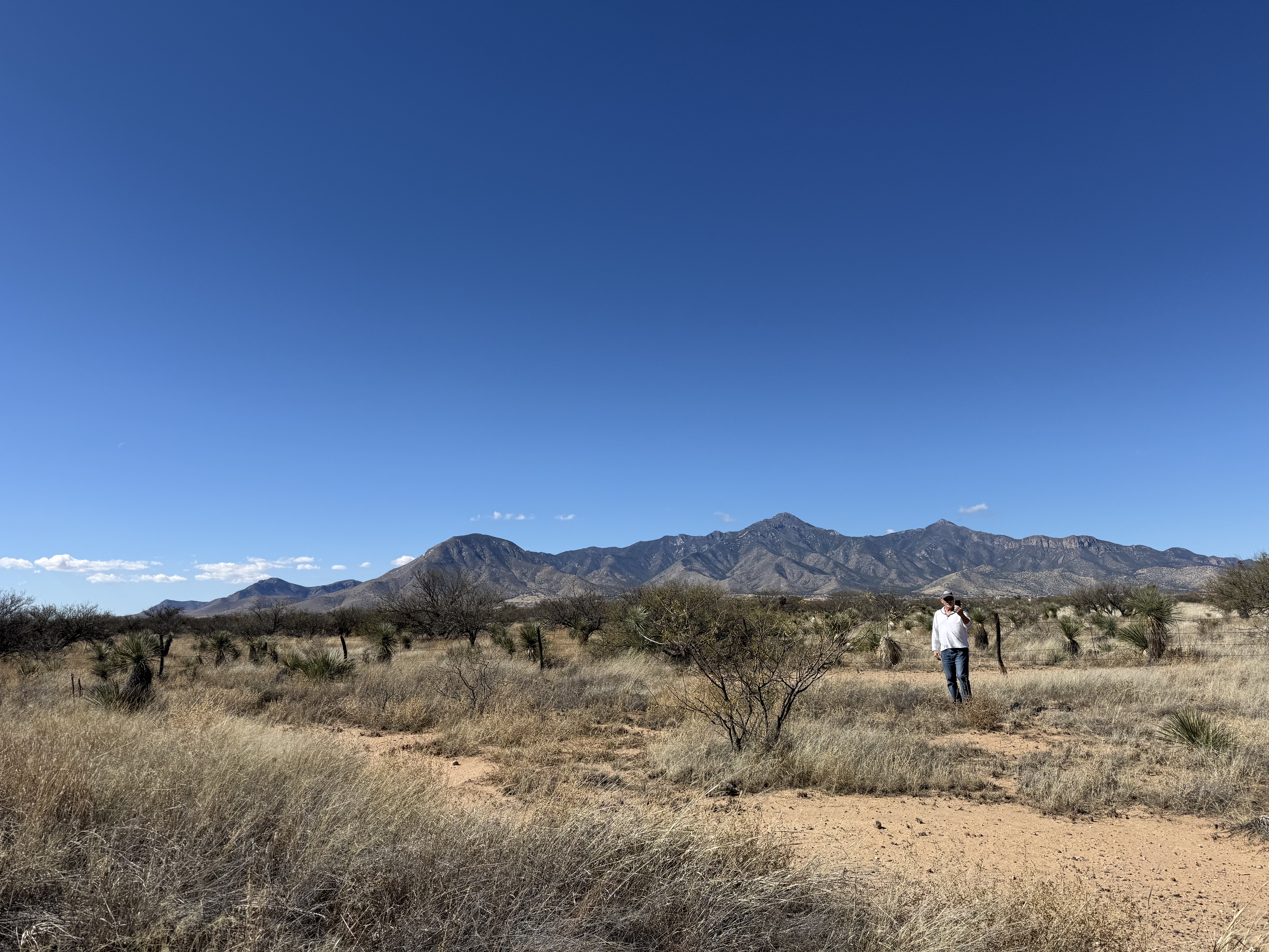
This system of rectangles started in 1785, with nascent Americans picking the point where the Ohio River crosses the Pennsylvania line to draw a much of 640 acre rectangles, subdivide further, sell it off and charge people tax for the privilege of owning it. My rectangle is a lovely four acres in the eastern shadow of the Huachuca Mountains. It doesn’t have an address yet. In fact, its lack of any redeeming attributes is what we love a bout it. While it has no address, it’s sort of on a road. The road has a name: East Cactus Ranch, but it’s not really a road. Its dirt, has a gate at the entrance for some reason, is not maintained by the county, and has trees growing in it. There is no nearby electricity or water, and is surrounded by many more rectangles – all empty except one – of various sizes. Perfect! The one neighbor, Bruce, is a nice fellow. We’ve only talked on the phone, but he keeps a neat home with a chicken coop. I called him just to say we’d probably end up neighbors. He likes it there, but is tired of taking care of his own dirt road. First time I spoke to him he said, “We’re all Republicans out here.” I said, “Not for long.” Next time we spoke, after he was out hunting javelinas for the day, he made it a point I knew when the Pride celebration was in Bisbee. We’ll get on just fine. He’s got my six.
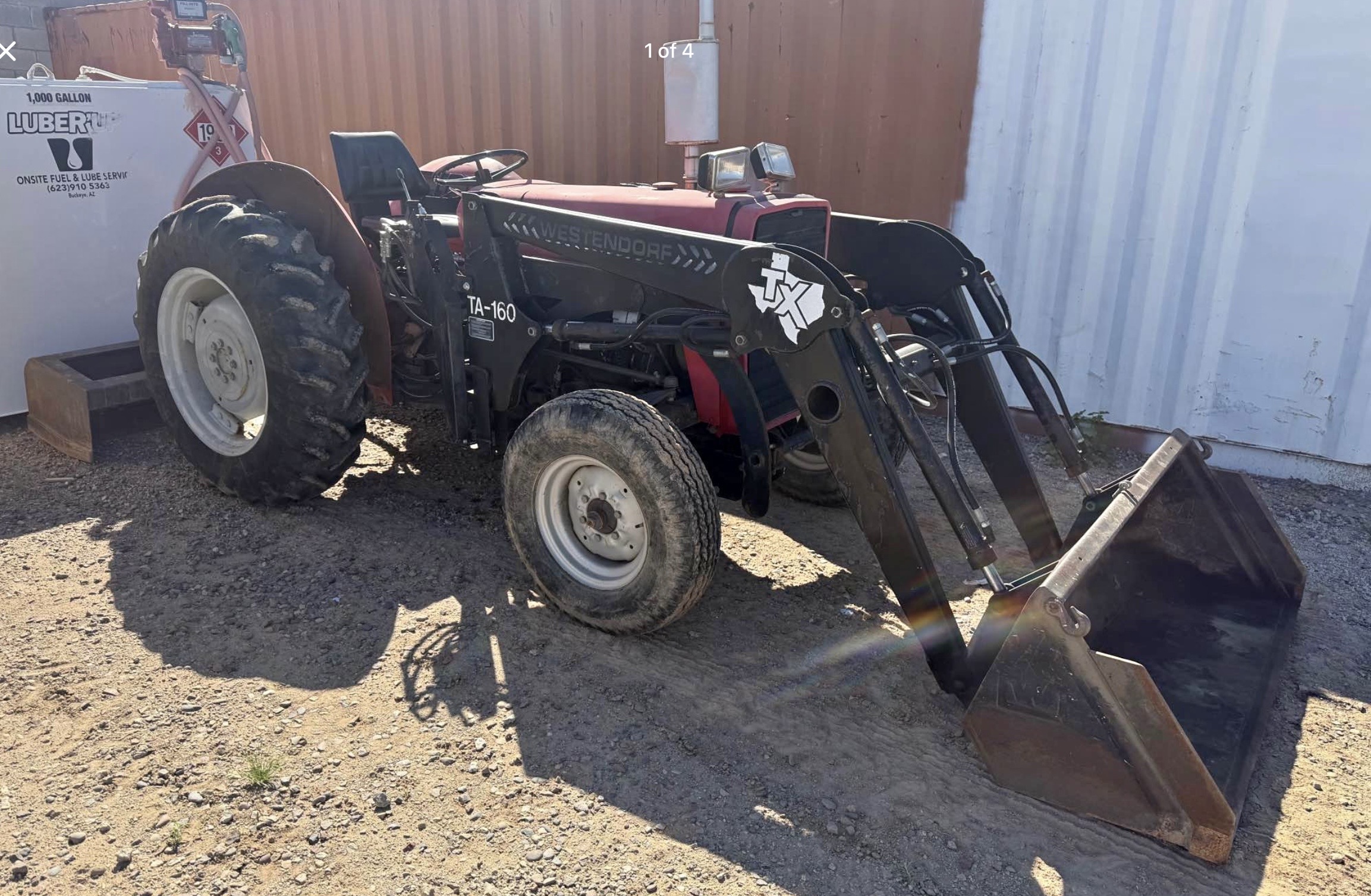
Having no water or electricity nearby is excellent. It may keep folks from building near me, for a while anyways. We’re going to build an off-grid homestead using some of the skills and behavior we’ve learned living on the road. We do have to have a proper septic system put in, but otherwise Cochise County is pretty flexible with what we can do on the land. We even have the option of opting out of building permits. We’re doing all of this on a pretty modest budget, but we think it can work. Once we start to build, the county will let us stay on the land in our camper. Honestly, the part I’m really excited about is shopping for a tractor. I really want a tractor.
Like a lot of the desert, the offerings of this land reveal themselves slowly and with careful observation. Little by little we’ll learn what our new area holds. There’s Miller Peak at almost 9500’; the SanPedro River; Carr, Brown and Ramsey Canyons. There’s poetry night at the Copper Quinn Library in Bisbee. Our little dirt is part of the Sky Islands – 55 distinct mountain ranges that comprise a Venn Diagram of three biomes: Sonoran Desert, Chihuahuan Desert and the Great Plains. We’ll be at around 4200’ of elevation, so not the hottest, but it’ll get hot. The greatest degradation of the land is the Border Wall with Mexico. We can see it from our place. To us, it speaks to fear and the refusal to honestly accept one’s place in the world. The refusal of the US to be honest and open with neighbors, the arrogance to ignore that the land and plants and animals have some rights, too. I won’t let that keep me down. I’ll still do my best to live with respect, and be good to people I run across because some days I’m the new person and some days I welcome the new person.

Dearest Joe (and Holly too) Your story is fascinating and exudes clear and spiritual judgement. You brought a few moments of happiness to this “broken world” I am living in. It is the price I pay gladly for having loved someone as wonderful as Robert. I am truly happy for you both…but still hope you will visit CT once in awhile….Buona fortuna and love, Carol Schpero
Good to hear from you Carol! We still plan to travel plenty. But we have fallen in love with Arizona.